Grotto Falls
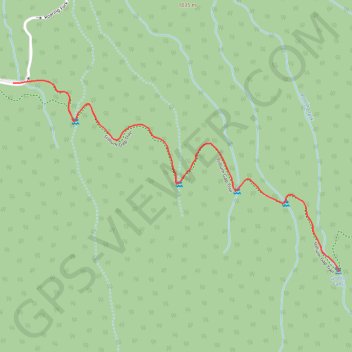
Interactive map
GPS track profile
About this GPS track
Name: Grotto Falls GPS track, route, trail
Coordinates: 35.67384 -83.46313 35.68033 -83.44951
Topography: Sevier County topographic map, elevation, terrain
Other GPS tracks
Click on a GPS track to view its route, statistics and profile.
Grotto Falls via Trillium Gap Trail in Great Smoky Mountains National Park
United States > Tennessee > Sevier County
The hike to Grotto Falls offers a refreshing woodland experience within Great Smoky Mountains National Park. The trail takes you through a lush forest, featuring streams and wildflowers, leading to the 25-foot high Grotto Falls, where you can walk behind the waterfall—a rare and exciting feature of the hike.…
Distance: 2.7 mi • Elevation gain: 925 ft • Maximum elevation: 3,819 ft
Great Smoky Mountains Appalachian Trail
United States > North Carolina > Clay County
Hike through Great Smoky Mountains along Appalachian Trail via Standing Indian, Ridgepole Mountain, Yellow Bald, Wine Spring Bald, Copper Ridge Bald, Cheoah Bald, Wauchecha Bald, Fontana Dam, Thunderhead Mountain, Clingmans Dome, Mount Kephart and Mount Guyot. #Hike #Mountain #Nature #Forest #Lake #Appalachian
Distance: 144.0 mi • Elevation gain: 29,111 ft • Maximum elevation: 6,604 ft