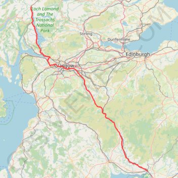
United Kingdom to Beinglas Campsite
- Distance: 133.9 mi
- Elevation gain: 6,027 ft
- Maximum elevation: 1,043 ft
- Elevation loss: 6,014 ft
- Minimum elevation: 0 ft
Interactive map
GPS track profile
About this GPS track
Name: United Kingdom to Beinglas Campsite GPS track, route, trail
Start: A74(M), Kirkandrews, Dumfries and Galloway, Écosse, DG16 5JD, Royaume-Uni (54.99482 -3.05256)
Coordinates: 54.99482 -4.72627 56.33179 -3.05256
Other GPS tracks
Click on a GPS track to view route, its statistics and profile.
Lowther hills hillwalk
United Kingdom > Scotland > Dumfries and Galloway
Distance: 8.3 mi • Elevation gain: 1,949 ft • Maximum elevation: 2,398 ft