Rainbow Falls
Interactive map
GPS track profile
About this GPS track
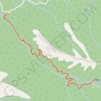
Name: Rainbow Falls GPS track, route, trail
Coordinates: 35.66070 -83.48660 35.67576 -83.46376
Topography: Sevier County topographic map, elevation, terrain
Other GPS tracks
Click on a GPS track to view its route, statistics and profile.
Rainbow Falls Trail in Great Smoky Mountains National Park
United States > Tennessee > Sevier County
The Rainbow Falls Trail offers a breathtaking experience with its lush, forested pathways leading to the stunning Rainbow Falls, known for its impressive 80-foot drop. Along the hike, visitors can enjoy views of LeConte Creek, several picturesque footbridges, and vibrant wildflowers in spring. This moderately…
Distance: 5.4 mi • Elevation gain: 1,916 ft • Maximum elevation: 4,314 ft
Great Smoky Mountains Appalachian Trail
United States > North Carolina > Clay County
Hike through Great Smoky Mountains along Appalachian Trail via Standing Indian, Ridgepole Mountain, Yellow Bald, Wine Spring Bald, Copper Ridge Bald, Cheoah Bald, Wauchecha Bald, Fontana Dam, Thunderhead Mountain, Clingmans Dome, Mount Kephart and Mount Guyot. #Hike #Mountain #Nature #Forest #Lake #Appalachian
Distance: 144.0 mi • Elevation gain: 29,111 ft • Maximum elevation: 6,604 ft