Morning Run
- Distance: 8.5 mi
- Elevation gain: 518 ft
- Maximum elevation: 112 ft
- Elevation loss: 531 ft
- Minimum elevation: -10 ft
- Moving time: 1 h 4 m
- Moving speed: 7.9 mph
- Maximum speed: 34.5 mph
- Total time: 1 h 4 m
- Global speed: 7.9 mph
- Date: 04/23/2023
Interactive map
GPS track profile
About this GPS track
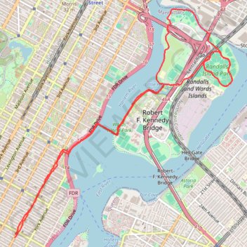
Name: Morning Run GPS track, route, trail
Coordinates: 40.77156 -73.95322 40.80195 -73.91493
Topography: New York topographic map
Other GPS tracks
Click on a GPS track to view route, its statistics and profile.
Traversée New York
États-Unis d'Amérique > New York > New York
Vélo. En aller simple. #Vélo
Distance: 26.8 mi • Elevation gain: 1,240 ft • Maximum elevation: 141 ft
Montréal - New York
Canada > Québec > Agglomération de Montréal > Montréal
Distance: 396.0 mi • Elevation gain: 13,563 ft • Maximum elevation: 988 ft