Nicolas_Vanvyve_2021-09-02
- Distance: 9.6 mi
- Elevation gain: 118 ft
- Maximum elevation: 377 ft
- Elevation loss: 118 ft
- Minimum elevation: 335 ft
- Moving time: 4 h 4 m
- Moving speed: 2.4 mph
- Maximum speed: 4.4 mph
- Total time: 6 h 18 m
- Global speed: 1.5 mph
- Date: 09/02/2021
Interactive map
GPS track profile
About this GPS track
Name: Nicolas_Vanvyve_2021-09-02 GPS track, route, trail
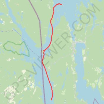
Start: Årjängs kommun, Comté de Värmland, Suède (59.36492 11.86910)
End: Dano Nr. 7, S 508, Grunnerud, Årjängs kommun, Comté de Värmland, Suède (59.24855 11.84434)
Coordinates: 59.24779 11.82262 59.36518 11.86932
Other GPS tracks
Click on a GPS track to view route, its statistics and profile.
Nicolas_Vanvyve_2021-08-29_11-38-26
Distance: 9.3 mi • Elevation gain: 135 ft • Maximum elevation: 351 ft
Nicolas_Vanvyve_2021-08-28_16-10-47
Distance: 7.0 mi • Elevation gain: 180 ft • Maximum elevation: 374 ft
Nicolas_Vanvyve_2021-09-03
Distance: 6.4 mi • Elevation gain: 62 ft • Maximum elevation: 358 ft