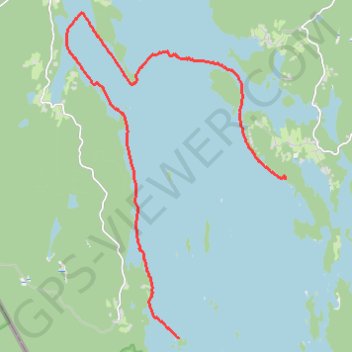
Nicolas_Vanvyve_2021-08-29_11-38-26
- Distance: 9.3 mi
- Elevation gain: 135 ft
- Maximum elevation: 351 ft
- Elevation loss: 135 ft
- Minimum elevation: 328 ft
- Moving time: 4 h 35 m
- Moving speed: 2.0 mph
- Maximum speed: 4.4 mph
- Total time: 6 h 13 m
- Global speed: 1.5 mph
- Date: 08/29/2021
Interactive map
GPS track profile
About this GPS track
Name: Nicolas_Vanvyve_2021-08-29_11-38-26 GPS track, route, trail
Start: Dano 17 Getöarna, S 500, Båstnäs, Årjängs kommun, Comté de Värmland, Suède (59.35770 11.85971)
End: Byggningen, Årjängs kommun, Comté de Värmland, Suède (59.38620 11.89651)
Coordinates: 59.35770 11.82062 59.41527 11.89676
Other GPS tracks
Click on a GPS track to view route, its statistics and profile.
Nicolas_Vanvyve_2021-08-28_16-10-47
Distance: 7.0 mi • Elevation gain: 180 ft • Maximum elevation: 374 ft
Nicolas_Vanvyve_2021-09-02
Distance: 9.6 mi • Elevation gain: 118 ft • Maximum elevation: 377 ft
Nicolas_Vanvyve_2021-09-01
Suède > Comté de Västra Götaland
Distance: 12.6 mi • Elevation gain: 102 ft • Maximum elevation: 377 ft
Nicolas_Vanvyve_2021-08-30_10-45-33 (merged)
Distance: 14.9 mi • Elevation gain: 253 ft • Maximum elevation: 384 ft
Nicolas_Vanvyve_2021-08-30
Distance: 15.2 mi • Elevation gain: 361 ft • Maximum elevation: 420 ft