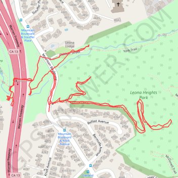
Leona Heights short fire trail hike
Oakland Walking
- Distance: 1.9 mi
- Elevation gain: 423 ft
- Maximum elevation: 512 ft
- Elevation loss: 423 ft
- Minimum elevation: 312 ft
- Moving time: 46 m 23 s
- Moving speed: 2.4 mph
- Maximum speed: 12.4 mph
- Total time: 1 h 1 m
- Global speed: 1.8 mph
- Date: 05/05/2024
Interactive map
GPS track profile
About this GPS track
Name: Leona Heights short fire trail hike GPS track, route, trail
Coordinates: 37.79004 -122.18150 37.79265 -122.17533
Topography: Oakland topographic map
Other GPS tracks
Click on a GPS track to view route, its statistics and profile.