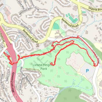
Oakland - McCrea Park and Leona Heights Park Loop
Loop hike in McCrea Park and Leona Heights Park via Oakland Casting Club Pools, Oakleaf Street, York Trail, Campus Drive, McDonell Trail and Old Survivor Redwood Tree. #Hike #Loop #Park #Nature #Forest
- Distance: 3.3 mi
- Elevation gain: 745 ft
- Maximum elevation: 856 ft
- Elevation loss: 748 ft
- Minimum elevation: 308 ft
- Moving time: 1 h 35 m
- Moving speed: 2.1 mph
- Maximum speed: 5.0 mph
- Total time: 1 h 50 m
- Global speed: 1.8 mph
- Date: 03/17/2024
Interactive map
GPS track profile
About this GPS track
Name: Oakland - McCrea Park and Leona Heights Park Loop GPS track, route, trail
Coordinates: 37.79124 -122.18267 37.79500 -122.16776
Topography: Oakland topographic map