Howth - Dublin
Interactive map
GPS track profile
About this GPS track
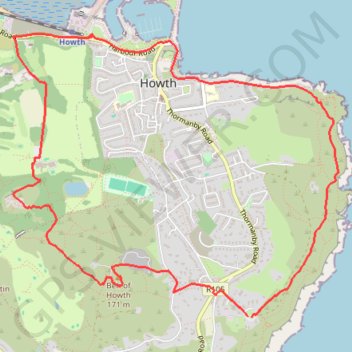
Name: Howth - Dublin GPS track, route, trail
Coordinates: 53.37078 -6.08070 53.38895 -6.04571
Other GPS tracks
Click on a GPS track to view route, its statistics and profile.
Howth Bog of Frogs Loop
Irlande > County Dublin > Howth
Distance: 7.4 mi • Elevation gain: 1,391 ft • Maximum elevation: 407 ft
TT22 J4 J2/06 : Dublin à Belfast
Irlande > County Dublin > Dublin
Distance: 155.5 mi • Elevation gain: 8,560 ft • Maximum elevation: 1,280 ft
RT5-1 Rosslare - Kinsale
Distance: 2,402.9 mi • Elevation gain: 118,488 ft • Maximum elevation: 1,719 ft
Howth Bog of Frogs Loop
Ireland > County Dublin > Howth
Distance: 7.4 mi • Elevation gain: 1,404 ft • Maximum elevation: 407 ft