Import a GPX file

Pushawalla Palms Loop

Loop hike from Indian Palms Trailhead to Pushawalla Palms in the Indio Hills Palms Park. #Hike #Loop #Nature #Desert #Forest #Park

  • Distance: 4.8 mi
  • Elevation gain: 741 ft
  • Maximum elevation: 823 ft
  • Elevation loss: 738 ft
  • Minimum elevation: 522 ft

Interactive map

GPS track profile

About this GPS track

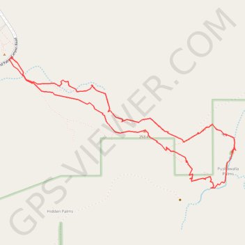
Name: Pushawalla Palms Loop GPS track, route, trail

Start: Hidden Palms, Riverside County, California, United States (33.83181 -116.29606)

End: Hidden Palms, Riverside County, California, United States (33.83174 -116.29605)

Coordinates: 33.82256 -116.30735 33.83531 -116.28075

Topography: Riverside County topographic map

Other GPS tracks

Click on a GPS track to view route, its statistics and profile.

Pushawalla Palms and Hidden Palms Loop

United States > California > Riverside County > Willis Palms

Loop hike to Pushawalla Palms and Hidden Palms in the Coachella Valley Preserve. #Hike #Loop #Nature #Desert

Distance: 4.9 mi • Elevation gain: 725 ft • Maximum elevation: 827 ft