Hiking Canyonlands Needles
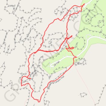
Loop hike via Squaw Flat Loop, Big Spring Canyon Trail in the Needles Districtand and the Canyonlands National Park. #Hike #Loop #Nature #Rock #Park
- Distance: 2.2 mi
- Elevation gain: 367 ft
- Maximum elevation: 5,295 ft
- Elevation loss: 367 ft
- Minimum elevation: 5,128 ft
- Moving time: 55 m 33 s
- Moving speed: 2.4 mph
- Maximum speed: 3.8 mph
- Total time: 1 h 2 m
- Global speed: 2.1 mph
- Date: 03/14/2024
Interactive map
GPS track profile
About this GPS track
Name: Hiking Canyonlands Needles GPS track, route, trail
Coordinates: 38.14012 -109.80874 38.14761 -109.80258
Topography: San Juan County topographic map
Other GPS tracks
Click on a GPS track to view route, its statistics and profile.