Dog park and business park
- Distance: 18.6 mi
- Elevation gain: 1,079 ft
- Maximum elevation: 6,650 ft
- Elevation loss: 1,079 ft
- Minimum elevation: 6,362 ft
- Moving time: 1 h 42 m
- Moving speed: 10.9 mph
- Maximum speed: 25.1 mph
- Total time: 2 h 12 m
- Global speed: 8.4 mph
- Date: 04/18/2024
Interactive map
GPS track profile
About this GPS track
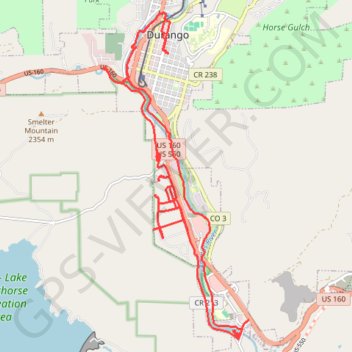
Name: Dog park and business park GPS track, route, trail
Start: 947, East 4th Avenue, Durango, La Plata County, Colorado, 81302, United States (37.27333 -107.87691)
End: 947, East 4th Avenue, Durango, La Plata County, Colorado, 81302, United States (37.27332 -107.87693)
Coordinates: 37.22028 -107.89163 37.28086 -107.85750
Topography: Durango topographic map
Other GPS tracks
Click on a GPS track to view route, its statistics and profile.