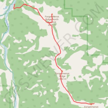
Elbow River - Forgetmenot Ridge - Forgetmenot Mountain
#Hike #Elbow #Forgetmenot
- Distance: 6.2 mi
- Elevation gain: 3,176 ft
- Maximum elevation: 7,631 ft
- Elevation loss: 846 ft
- Minimum elevation: 5,249 ft
Interactive map
GPS track profile
About this GPS track
Name: Elbow River - Forgetmenot Ridge - Forgetmenot Mountain GPS track, route, trail
Start: Wildhorse Trail, Division No. 15, Alberta, Canada (50.79956 -114.84047)
End: Forgetmenot Mt, Division No. 15, Alberta, Canada (50.75272 -114.78107)
Coordinates: 50.75245 -114.84123 50.79957 -114.78107
Other GPS tracks
Click on a GPS track to view route, its statistics and profile.
12-OCT-21 16:57:46
Canada > Alberta > Division No. 15
Distance: 16.5 mi • Elevation gain: 3,537 ft • Maximum elevation: 7,641 ft