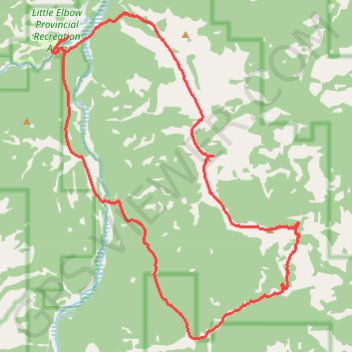
12-OCT-21 16:57:46
- Distance: 16.5 mi
- Elevation gain: 3,537 ft
- Maximum elevation: 7,641 ft
- Elevation loss: 3,537 ft
- Minimum elevation: 5,256 ft
- Moving time: 5 h 59 m
- Moving speed: 2.8 mph
- Maximum speed: 5.9 mph
- Total time: 7 h 18 m
- Global speed: 2.3 mph
- Date: 10/12/2021
Interactive map
GPS track profile
About this GPS track
Name: 12-OCT-21 16:57:46 GPS track, route, trail
End: Ford Knoll Loop, Division No. 15, Alberta, Canada (50.79439 -114.85294)
Coordinates: 50.72861 -114.85841 50.79956 -114.77317
Other GPS tracks
Click on a GPS track to view route, its statistics and profile.
Elbow River - Forgetmenot Ridge - Forgetmenot Mountain
Canada > Alberta > Division No. 15
#Hike #Elbow #Forgetmenot
Distance: 6.2 mi • Elevation gain: 3,176 ft • Maximum elevation: 7,631 ft