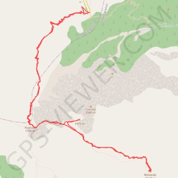
Le Gigilos et le Volokias
Randonnée pédestre. En aller-retour. #Randonnée
- Distance: 7.2 mi
- Elevation gain: 4,134 ft
- Maximum elevation: 6,929 ft
- Elevation loss: 4,134 ft
- Minimum elevation: 4,042 ft
- Moving time: 5 h 34 m
- Moving speed: 1.3 mph
- Maximum speed: 3.2 mph
- Total time: 7 h 3 m
- Global speed: 1.0 mph
- Date: 07/17/2012
Interactive map
GPS track profile
About this GPS track
Name: Le Gigilos et le Volokias GPS track, route, trail
Start: Δήμος Πλατανιά, Περιφερειακή Ενότητα Χανίων, Crète, Région Crète, Grèce (35.30798 23.91828)
Coordinates: 35.28805 23.90884 35.30867 23.92790
Other GPS tracks
Click on a GPS track to view route, its statistics and profile.
Les gorges de Samaria
Grèce > Région Crète > Περιφερειακή Ενότητα Χανίων > Agía Rouméli
Randonnée depuis Agia Roumeli. #Randonnée
Distance: 9.8 mi • Elevation gain: 7,431 ft • Maximum elevation: 4,049 ft
Gorges de Samaria
Grèce > Région Crète > Περιφερειακή Ενότητα Χανίων > Agía Rouméli
Distance: 9.4 mi • Elevation gain: 7,228 ft • Maximum elevation: 4,049 ft