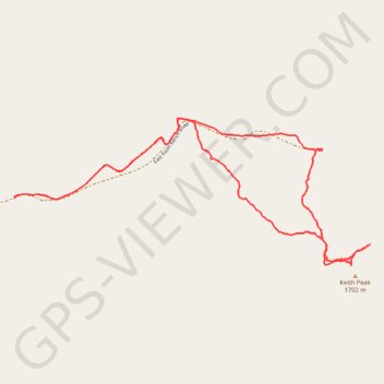
Keith Peak Loop
Loop hike to Keith Peak via East Keith Ranch Road. #Hike #Loop #Mountain #Nature
- Distance: 4.4 mi
- Elevation gain: 1,519 ft
- Maximum elevation: 5,653 ft
- Elevation loss: 1,519 ft
- Minimum elevation: 4,432 ft
- Moving time: 2 h 27 m
- Moving speed: 1.8 mph
- Maximum speed: 3.1 mph
- Total time: 3 h 34 m
- Global speed: 1.2 mph
- Date: 01/13/2024
Interactive map
GPS track profile
About this GPS track
Name: Keith Peak Loop GPS track, route, trail
Start: East Keith Ranch Road, Cochise County, Arizona, 85602, United States (32.11983 -110.24476)
End: East Keith Ranch Road, Cochise County, Arizona, 85602, United States (32.11984 -110.24477)
Coordinates: 32.11590 -110.24477 32.12446 -110.22046
Topography: Cochise County topographic map