Boucle de Teror
- Distance: 3.2 mi
- Elevation gain: 1,060 ft
- Maximum elevation: 2,369 ft
- Elevation loss: 1,060 ft
- Minimum elevation: 1,575 ft
Interactive map
GPS track profile
About this GPS track
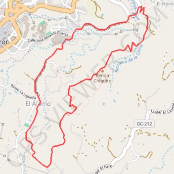
Name: Boucle de Teror GPS track, route, trail
Coordinates: 28.04832 -15.54506 28.06199 -15.53333
Other GPS tracks
Click on a GPS track to view route, its statistics and profile.
TGCC 2024 10.07.2023
Espagne > Las Palmas de Grande Canarie
Distance: 79.6 mi • Elevation gain: 23,612 ft • Maximum elevation: 5,728 ft