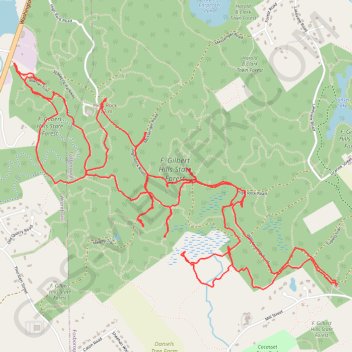
My Warner Trail hike in F. Gilbert Hills State Forest
- Distance: 8.5 mi
- Elevation gain: 719 ft
- Maximum elevation: 440 ft
- Elevation loss: 715 ft
- Minimum elevation: 197 ft
- Moving time: 4 h 8 m
- Moving speed: 2.1 mph
- Maximum speed: 3.6 mph
- Total time: 5 h 23 m
- Global speed: 1.6 mph
- Date: 04/27/2024
Interactive map
GPS track profile
About this GPS track
Name: My Warner Trail hike in F. Gilbert Hills State Forest GPS track, route, trail
Coordinates: 42.04966 -71.29390 42.06399 -71.26614
Topography: Norfolk County topographic map
Other GPS tracks
Click on a GPS track to view route, its statistics and profile.
Cambridge - Providence Express
United States > Massachusetts > Middlesex County > Cambridge
Alewife -> Providence
Distance: 63.2 mi • Elevation gain: 3,153 ft • Maximum elevation: 351 ft