Silver strand
Interactive map
GPS track profile
About this GPS track
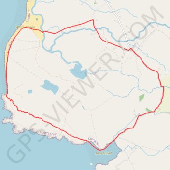
Name: Silver strand GPS track, route, trail
Coordinates: 53.64798 -9.91360 53.67118 -9.86642
Other GPS tracks
Click on a GPS track to view route, its statistics and profile.
Connemara - Day 1
Ireland > County Galway > Leenaun
#Bike
Distance: 38.6 mi • Elevation gain: 2,136 ft • Maximum elevation: 249 ft
RT5-1 Rosslare - Kinsale
Distance: 1,777.3 mi • Elevation gain: 89,833 ft • Maximum elevation: 1,378 ft
RT5-1 Rosslare - Kinsale
Distance: 2,402.9 mi • Elevation gain: 118,488 ft • Maximum elevation: 1,719 ft