Auto
- Distance: 32.5 mi
- Elevation gain: 2,270 ft
- Maximum elevation: 295 ft
- Elevation loss: 2,507 ft
- Minimum elevation: 0 ft
Interactive map
GPS track profile
About this GPS track
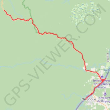
Name: Auto GPS track, route, trail
Start: Route de l'Est, Régina, Saint-Georges, Guyane, France (4.05640 -52.03967)
Coordinates: 3.84176 -52.03967 4.05640 -51.79374
Other GPS tracks
Click on a GPS track to view route, its statistics and profile.
Tracé actuel: 30 MARS 2015 09:15
France > Guyane > Camopi > Chanel
Distance: 85.4 mi • Elevation gain: 2,713 ft • Maximum elevation: 230 ft
UACA-MANGA
Distance: 92.8 mi • Elevation gain: 141 ft • Maximum elevation: 30 ft