Suuntoapp-Hiking-2021-10-30T07-18-07Z
- Distance: 8.8 mi
- Elevation gain: 3,035 ft
- Maximum elevation: 2,631 ft
- Elevation loss: 3,215 ft
- Minimum elevation: 174 ft
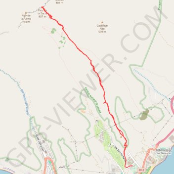
Interactive map
GPS track profile
About this GPS track
Name: Suuntoapp-Hiking-2021-10-30T07-18-07Z GPS track, route, trail
End: Solana Matorral, Pájara, Las Palmas, Îles Canaries, 35625, Espagne (28.05549 -14.32590)
Coordinates: 28.05492 -14.35579 28.10209 -14.32564