Andalousie
Randonnée entre Sevilla et El Real de la Jara. #Randonnée
- Distance: 50.6 mi
- Elevation gain: 4,754 ft
- Maximum elevation: 1,827 ft
- Elevation loss: 3,205 ft
- Minimum elevation: 10 ft
- Moving time: 20 h 47 m
- Moving speed: 2.4 mph
- Maximum speed: 4.8 mph
- Total time: 3 d 4 h
- Global speed: 0.7 mph
- Date: 03/08/2014
Interactive map
GPS track profile
About this GPS track
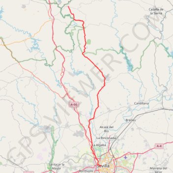
Name: Andalousie GPS track, route, trail
Coordinates: 37.38510 -6.14988 37.94816 -5.98614
Other GPS tracks
Click on a GPS track to view route, its statistics and profile.
Eurovelo 01 Spain + Portugal
France > Nouvelle-Aquitaine > Pyrénées-Atlantiques > Hendaye
Distance: 1,930.7 mi • Elevation gain: 100,367 ft • Maximum elevation: 4,931 ft
EuroVelo 1 (Spain)
Espagne > Andalousie > Côte occidentale > Ayamonte
Distance: 842.4 mi • Elevation gain: 47,858 ft • Maximum elevation: 4,331 ft
Southern section — European Divide Trail
France > Auvergne-Rhône-Alpes > Drôme > Valence
Distance: 1,506.1 mi • Elevation gain: 139,026 ft • Maximum elevation: 6,578 ft
Southern Section — European Divide Trail
Espagne > Andalousie > Cazorla
Distance: 516.0 mi • Elevation gain: 63,166 ft • Maximum elevation: 7,001 ft
Stage 26: Valence to Saint-Jean-de-Fos — European Divide Trail
France > Auvergne-Rhône-Alpes > Drôme > Valence
Distance: 1,506.1 mi • Elevation gain: 139,026 ft • Maximum elevation: 6,578 ft
EuroVelo 1 (Spain)
Espagne > Andalousie > Côte occidentale > Ayamonte > Pozo del Camino > Fotea
Distance: 838.7 mi • Elevation gain: 44,754 ft • Maximum elevation: 4,331 ft
Stage 26: Valence to Saint-Jean-de-Fos — European Divide Trail
Distance: 533.8 mi • Elevation gain: 53,930 ft • Maximum elevation: 4,888 ft
Vila do Bispo -> Distrito 4 (500,7 km)
Distance: 308.1 mi • Elevation gain: 10,604 ft • Maximum elevation: 541 ft
Vila do Bispo -> Distrito 4 (495,2 km)
Distance: 811.8 mi • Elevation gain: 75,879 ft • Maximum elevation: 7,001 ft
Vila do Bispo -> Distrito 4 (483,3 km)
Distance: 298.5 mi • Elevation gain: 9,836 ft • Maximum elevation: 597 ft