LOF_40_geitgaljen
- Distance: 5.0 mi
- Elevation gain: 3,278 ft
- Maximum elevation: 3,274 ft
- Elevation loss: 3,278 ft
- Minimum elevation: 23 ft
Interactive map
GPS track profile
About this GPS track
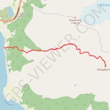
Name: LOF_40_geitgaljen GPS track, route, trail
Start: 87, Lilandveien, Eide, Varden, Vågan, Nordland, 8316, Norvège (68.34895 14.74433)
End: Vegstøa, Lilandveien, Eide, Varden, Vågan, Nordland, 8316, Norvège (68.34895 14.74438)
Coordinates: 68.34431 14.74433 68.34997 14.81354
Other GPS tracks
Click on a GPS track to view route, its statistics and profile.
Stage 1: Arctic Ocean to Väylä — European Divide Trail
Distance: 1,730.5 mi • Elevation gain: 78,159 ft • Maximum elevation: 2,369 ft