Maribaya - The Lodge
Randonnée pédestre. #Randonnée
- Distance: 5.0 mi
- Elevation gain: 1,224 ft
- Maximum elevation: 4,304 ft
- Elevation loss: 774 ft
- Minimum elevation: 3,599 ft
Interactive map
GPS track profile
About this GPS track
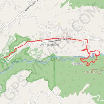
Name: Maribaya - The Lodge GPS track, route, trail
End: 15, Kabupaten Bandung Barat, Java occidental, Jawa, 40197, Indonésie (-6.82938 107.68815)
Coordinates: -6.83369 107.65740 -6.82359 107.69230