Cape Horn Loop
Interactive map
GPS track profile
About this GPS track
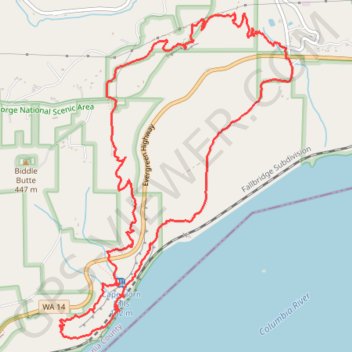
Name: Cape Horn Loop GPS track, route, trail
Start: Cape Horn Trail, Skamania County, Washington, 97010, United States (45.58939 -122.17916)
End: Cape Horn Trail, Skamania County, Washington, 97010, United States (45.58939 -122.17916)
Coordinates: 45.56712 -122.20401 45.59210 -122.17844
Topography: Skamania County topographic map
Other GPS tracks
Click on a GPS track to view route, its statistics and profile.
Expedition to Sedum Ridge
United States > Oregon > Multnomah County
Distance: 133.4 mi • Elevation gain: 16,709 ft • Maximum elevation: 3,835 ft