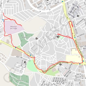
T2020-01-24-19-35
- Distance: 2.0 mi
- Elevation gain: 249 ft
- Maximum elevation: 322 ft
- Elevation loss: 427 ft
- Minimum elevation: 69 ft
- Moving time: 47 m 50 s
- Moving speed: 2.5 mph
- Maximum speed: 7.2 mph
- Total time: 1 h 18 m
- Global speed: 1.5 mph
- Date: 01/24/2020
Interactive map
GPS track profile
About this GPS track
Name: T2020-01-24-19-35 GPS track, route, trail
Coordinates: 35.74059 -5.81683 35.74721 -5.80612
Other GPS tracks
Click on a GPS track to view route, its statistics and profile.
Maroc en boucle depuis Tanger
Maroc > pachalik de Tanger > Tanger
Distance: 1,882.0 mi • Elevation gain: 89,413 ft • Maximum elevation: 7,549 ft
T2020-01-14-19-47
Maroc > pachalik de Tanger > Tanger
Distance: 4.9 mi • Elevation gain: 325 ft • Maximum elevation: 358 ft