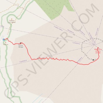
Montanha do Pico via Trilho do Pico
- Distance: 2.2 mi
- Elevation gain: 3,550 ft
- Maximum elevation: 7,595 ft
- Elevation loss: 7 ft
- Minimum elevation: 4,042 ft
Interactive map
GPS track profile
About this GPS track
Name: Montanha do Pico via Trilho do Pico GPS track, route, trail
Start: Casa da Montanha, Trilho do Pico, Candelária, Madalena, Azores, 9950, Portugal (38.47060 -28.42660)
Coordinates: 38.46485 -28.42660 38.47086 -28.39894
Other GPS tracks
Click on a GPS track to view route, its statistics and profile.
Montanha do Pico, Açores
Portugal > Madalena > Candelária
Randonnée pédestre. En aller-retour. #Randonnée
Distance: 5.4 mi • Elevation gain: 3,593 ft • Maximum elevation: 7,595 ft