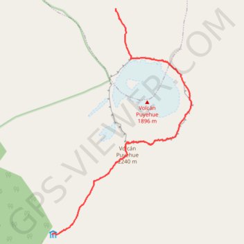
East ridge of the Puyehue Volcano crater
Randonnée pédestre. En aller simple. #Randonnée
- Distance: 6.5 mi
- Elevation gain: 2,887 ft
- Maximum elevation: 7,320 ft
- Elevation loss: 3,783 ft
- Minimum elevation: 4,524 ft
- Moving time: 2 h 52 m
- Moving speed: 2.2 mph
- Maximum speed: 11.1 mph
- Total time: 6 h 35 m
- Global speed: 1.0 mph
- Date: 01/25/2014
Interactive map
GPS track profile
About this GPS track
Name: East ridge of the Puyehue Volcano crater GPS track, route, trail
Start: Lago Ranco, Provincia de Ranco, Fleuves, Chili (-40.56142 -72.12201)
End: Sendero volcán Puyehue, Río Bueno, Provincia de Ranco, Fleuves, Chili (-40.61514 -72.14212)
Coordinates: -40.61514 -72.14214 -40.56142 -72.09847