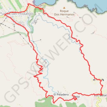
Ten_51_Punta del Hidalgo - Batan de Abajo
- Distance: 7.8 mi
- Elevation gain: 2,927 ft
- Maximum elevation: 1,946 ft
- Elevation loss: 2,927 ft
- Minimum elevation: 39 ft
Interactive map
GPS track profile
About this GPS track
Name: Ten_51_Punta del Hidalgo - Batan de Abajo GPS track, route, trail
Coordinates: 28.54581 -16.32525 28.57163 -16.29596
Other GPS tracks
Click on a GPS track to view route, its statistics and profile.
Punta del Hidalgo
Espagne > San Cristóbal de La Laguna
Sentier de Chinamada. #Randonnée
Distance: 2.8 mi • Elevation gain: 2,343 ft • Maximum elevation: 1,919 ft