Mount Sanitas and Sanitas Valley Loop Trail
Interactive map
GPS track profile
About this GPS track
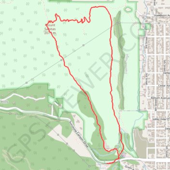
Name: Mount Sanitas and Sanitas Valley Loop Trail GPS track, route, trail
Coordinates: 40.02016 -105.30573 40.03588 -105.29564
Topography: Boulder topographic map
Other GPS tracks
Click on a GPS track to view route, its statistics and profile.
Anemone Point and Reflection Point Loop (Boulder)
United States > Colorado > Boulder County
Loop hike from The Peoles' Crossing to Anemone Point and Reflection Point via Red Rocks Trail, Anemone Loop Trail and Red Rocks Spur Trail in the Boulder Open Space and Mountain Parks. #Hike #Loop #Nature #Mountain #Forest #Park #Overlook
Distance: 4.8 mi • Elevation gain: 1,102 ft • Maximum elevation: 6,362 ft