Aglantzia Course à pied
- Distance: 0.3 mi
- Elevation gain: 20 ft
- Maximum elevation: 581 ft
- Elevation loss: 20 ft
- Minimum elevation: 564 ft
- Moving time: 2 m 31 s
- Moving speed: 7.6 mph
- Maximum speed: 9.6 mph
- Total time: 2 m 31 s
- Global speed: 7.6 mph
- Date: 01/23/2023
Interactive map
GPS track profile
About this GPS track
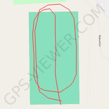
Name: Aglantzia Course à pied GPS track, route, trail
Start: Βαρωσίων, Aglangia, Nicosie, Chypre, 2121, Chypre (35.14114 33.37900)
End: Βαρωσίων, Aglangia, Nicosie, Chypre, 2121, Chypre (35.14118 33.37901)
Coordinates: 35.14114 33.37864 35.14219 33.37920
Other GPS tracks
Click on a GPS track to view route, its statistics and profile.
Cyprus Circle Tour 2023
Cyprus > Cyprus > Germasogeia
Distance: 395.7 mi • Elevation gain: 24,505 ft • Maximum elevation: 2,152 ft