Bridal Veil Falls Trail
- Distance: 0.7 mi
- Elevation gain: 308 ft
- Maximum elevation: 276 ft
- Elevation loss: 295 ft
- Minimum elevation: 102 ft
- Moving time: 22 m 17 s
- Moving speed: 1.9 mph
- Maximum speed: 5.5 mph
- Total time: 27 m 41 s
- Global speed: 1.6 mph
- Date: 06/09/2024
Interactive map
GPS track profile
About this GPS track
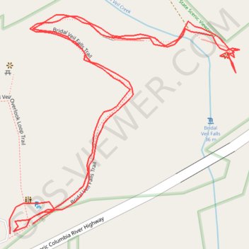
Name: Bridal Veil Falls Trail GPS track, route, trail
Coordinates: 45.55359 -122.18243 45.55529 -122.17988
Topography: Multnomah County topographic map
Other GPS tracks
Click on a GPS track to view route, its statistics and profile.
Expedition to Sedum Ridge
United States > Oregon > Multnomah County
Distance: 133.4 mi • Elevation gain: 16,709 ft • Maximum elevation: 3,835 ft