The Golden Cathedral
Hike to The Golden Cathedral via Golden Cathedral Trail and Escalante River in the Glen Canyon National Recreation Area. #Hike #Nature #Canyon #Desert #Rock #River #Forest
- Distance: 9.2 mi
- Elevation gain: 1,644 ft
- Maximum elevation: 5,640 ft
- Elevation loss: 1,644 ft
- Minimum elevation: 4,557 ft
- Moving time: 2 h 1 m
- Moving speed: 4.6 mph
- Maximum speed: 22.3 mph
- Total time: 2 h 1 m
- Global speed: 4.6 mph
- Date: 03/09/2024
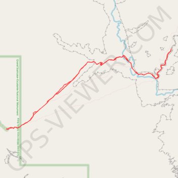
Interactive map
GPS track profile
About this GPS track
Name: The Golden Cathedral GPS track, route, trail
Start: Golden Cathedral Trailhead, Egypt Road, Garfield County, Utah, United States (37.59334 -111.21831)
End: Golden Cathedral Trailhead, Egypt Road, Garfield County, Utah, United States (37.59338 -111.21833)
Coordinates: 37.59319 -111.21834 37.61469 -111.16299
Topography: Garfield County topographic map