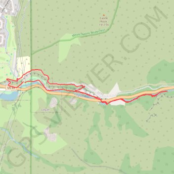
Logan Canyon Loop
Loop hike along Logan River from Ray Hugie Hydro Park via River Trail, Highline Trail and Bonneville Shoreline Trail. #Hike #Loop #Nature #River #Canyon #Mountain #Forest #Park
- Distance: 3.1 mi
- Elevation gain: 486 ft
- Maximum elevation: 4,918 ft
- Elevation loss: 472 ft
- Minimum elevation: 4,692 ft
- Moving time: 58 m 59 s
- Moving speed: 3.2 mph
- Maximum speed: 4.5 mph
- Total time: 1 h 2 m
- Global speed: 3.0 mph
- Date: 03/03/2024
Interactive map
GPS track profile
About this GPS track
Name: Logan Canyon Loop GPS track, route, trail
Start: US 89, Logan, Cache County, Utah, 84322, United States (41.74372 -111.78578)
End: Highline trail, Logan, Cache County, Utah, 84322, United States (41.74377 -111.78595)
Coordinates: 41.74121 -111.78853 41.74514 -111.76416
Topography: Logan topographic map