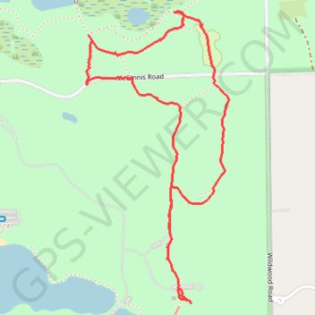
Holly State Recreation Area
Loop hike in the Holly State Recreation Area. #Hike #Loop #Nature #Forest
- Distance: 2.3 mi
- Elevation gain: 118 ft
- Maximum elevation: 1,096 ft
- Elevation loss: 115 ft
- Minimum elevation: 1,050 ft
- Moving time: 1 h 18 m
- Moving speed: 1.8 mph
- Maximum speed: 3.3 mph
- Total time: 1 h 20 m
- Global speed: 1.7 mph
- Date: 02/11/2024
Interactive map
GPS track profile
About this GPS track
Name: Holly State Recreation Area GPS track, route, trail
Start: Wildwood Road, Austin Corners, Oakland County, Michigan, 48442, United States (42.80999 -83.51519)
End: Wildwood Road, Austin Corners, Oakland County, Michigan, 48442, United States (42.80886 -83.51453)
Coordinates: 42.80830 -83.51929 42.81914 -83.51207
Topography: Oakland County topographic map