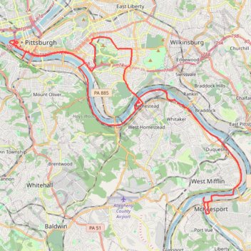
Four Rivers and Five Trails Loop
Loop hike along Monongahela River. #Hike #Loop #River #Nature #City
- Distance: 38.9 mi
- Elevation gain: 2,254 ft
- Maximum elevation: 1,112 ft
- Elevation loss: 2,251 ft
- Minimum elevation: 696 ft
- Moving time: 10 h 1 m
- Moving speed: 3.9 mph
- Maximum speed: 14.9 mph
- Total time: 10 h 38 m
- Global speed: 3.7 mph
- Date: 05/01/2021
Interactive map
GPS track profile
About this GPS track
Name: Four Rivers and Five Trails Loop GPS track, route, trail
Coordinates: 40.34487 -80.01326 40.44457 -79.84158
Topography: Pittsburgh topographic map
Other GPS tracks
Click on a GPS track to view route, its statistics and profile.