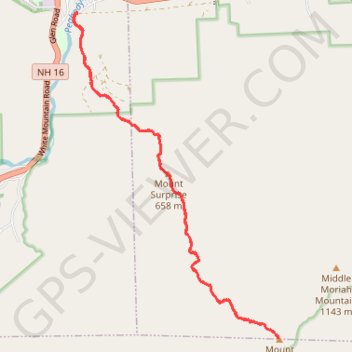
Mount Moriah
Hike from Peabody River to Mount Moriah via Carter-Moriah Trail and Mount Surprise in the White Mountain National Forest. #Hike #Mountain #Forest #Nature #River
- Distance: 8.9 mi
- Elevation gain: 3,189 ft
- Maximum elevation: 3,986 ft
- Elevation loss: 3,189 ft
- Minimum elevation: 794 ft
- Moving time: 4 h 26 m
- Moving speed: 2.0 mph
- Maximum speed: 5.5 mph
- Total time: 5 h 4 m
- Global speed: 1.8 mph
- Date: 08/14/2023
Interactive map
GPS track profile
About this GPS track
Name: Mount Moriah GPS track, route, trail
Start: 43, Bangor Street, Gorham, Coös County, New Hampshire, 03581, United States (44.38330 -71.16863)
End: 43, Bangor Street, Gorham, Coös County, New Hampshire, 03581, United States (44.38329 -71.16859)
Coordinates: 44.34043 -71.16948 44.38331 -71.13176
Topography: Coos County topographic map