Mount Rubidoux
Interactive map
GPS track profile
About this GPS track
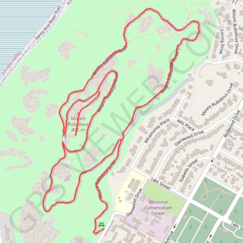
Name: Mount Rubidoux GPS track, route, trail
Coordinates: 33.97941 -117.39465 33.98780 -117.38762
Topography: Riverside topographic map
Name: Mount Rubidoux GPS track, route, trail
Coordinates: 33.97941 -117.39465 33.98780 -117.38762
Topography: Riverside topographic map