Artist Point
Interactive map
GPS track profile
About this GPS track
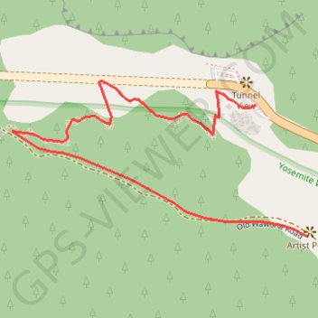
Name: Artist Point GPS track, route, trail
Start: Wawona Road, Mariposa County, California, United States (37.71513 -119.67666)
End: Old Wawona Road, Mariposa County, California, United States (37.71264 -119.67546)
Coordinates: 37.71264 -119.68250 37.71558 -119.67546
Topography: Mariposa County topographic map
Other GPS tracks
Click on a GPS track to view route, its statistics and profile.
Walker - Auberry
États-Unis d'Amérique > Californie > Mono County > Walker
Vélo. En aller simple entre Walker et Auberry. #Vélo
Distance: 220.0 mi • Elevation gain: 21,762 ft • Maximum elevation: 9,970 ft