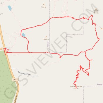
Iron Mountain Loop
Loop hike to Iron Mountain via Iron Mountain Peak Trail and Ellie Lane Trail. #Hike #Loop #Mountain #Nature #Forest #Lake
- Distance: 7.9 mi
- Elevation gain: 1,713 ft
- Maximum elevation: 2,638 ft
- Elevation loss: 1,722 ft
- Minimum elevation: 1,598 ft
- Moving time: 2 h 52 m
- Moving speed: 2.7 mph
- Maximum speed: 5.7 mph
- Total time: 3 h 24 m
- Global speed: 2.3 mph
- Date: 02/17/2024
Interactive map
GPS track profile
About this GPS track
Name: Iron Mountain Loop GPS track, route, trail
Start: Poway Road, Poway, San Diego County, California, United States (32.97835 -116.97352)
End: 14860, Highway 67, Poway, San Diego County, California, 92064, United States (32.97704 -116.97315)
Coordinates: 32.96997 -116.97357 32.98558 -116.94953
Topography: Poway topographic map
Other GPS tracks
Click on a GPS track to view route, its statistics and profile.