Abrams Falls
Interactive map
GPS track profile
About this GPS track
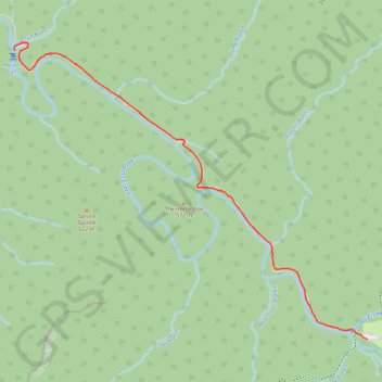
Name: Abrams Falls GPS track, route, trail
Coordinates: 35.59095 -83.87971 35.60984 -83.85201
Topography: Blount County topographic map, elevation, terrain
Other GPS tracks
Click on a GPS track to view its route, statistics and profile.
Abrams Falls Trail in Great Smoky Mountains National Park
United States > Tennessee > Blount County
The Abrams Falls Trail is a moderate round-trip hike that begins near the Cades Cove Loop. The trail winds through pine-oak forests and alongside Abrams Creek, offering scenic views of hemlock trees and rhododendrons. Hikers will encounter rocky terrain and several footbridges, with the final reward being…
Distance: 5.3 mi • Elevation gain: 748 ft • Maximum elevation: 1,808 ft