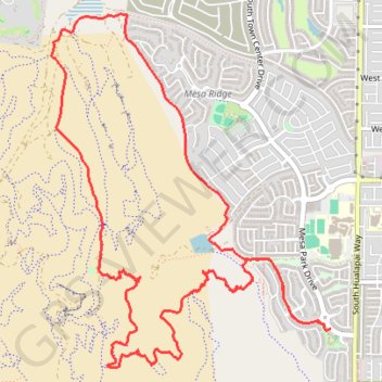
Summerin south mesa ridge explore
- Distance: 7.5 mi
- Elevation gain: 1,096 ft
- Maximum elevation: 3,412 ft
- Elevation loss: 1,109 ft
- Minimum elevation: 2,697 ft
- Moving time: 2 h 36 m
- Moving speed: 2.9 mph
- Maximum speed: 4.2 mph
- Total time: 2 h 37 m
- Global speed: 2.8 mph
- Date: 03/31/2024
Interactive map
GPS track profile
About this GPS track
Name: Summerin south mesa ridge explore GPS track, route, trail
Coordinates: 36.07130 -115.34331 36.09728 -115.31794
Topography: Clark County topographic map