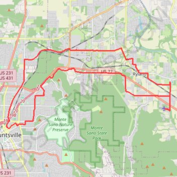
25 mile Bike Ride, Huntsville/Gurley AL
Moontown Airport
- Distance: 25.2 mi
- Elevation gain: 1,237 ft
- Maximum elevation: 1,007 ft
- Elevation loss: 1,237 ft
- Minimum elevation: 623 ft
- Moving time: 2 h 18 m
- Moving speed: 10.9 mph
- Maximum speed: 34.3 mph
- Total time: 2 h 58 m
- Global speed: 8.5 mph
- Date: 04/20/2024
Interactive map
GPS track profile
About this GPS track
Name: 25 mile Bike Ride, Huntsville/Gurley AL GPS track, route, trail
Coordinates: 34.73386 -86.58661 34.78642 -86.45652
Topography: Huntsville topographic map