Niševačka klisura (Niševac) - kružna tura
- Distance: 5.0 mi
- Elevation gain: 1,463 ft
- Maximum elevation: 1,486 ft
- Elevation loss: 1,453 ft
- Minimum elevation: 1,122 ft
Interactive map
GPS track profile
About this GPS track
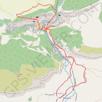
Name: Niševačka klisura (Niševac) - kružna tura GPS track, route, trail
Coordinates: 43.45809 22.08882 43.47667 22.10769
Topography: Svrljig Municipality topographic map
Other GPS tracks
Click on a GPS track to view route, its statistics and profile.
Tour d'Europe
France > Bretagne > Finistère > Concarneau > Landan Creis
Distance: 4,432.2 mi • Elevation gain: 146,335 ft • Maximum elevation: 7,982 ft
De Giromagny à Sofia
France > Bourgogne-Franche-Comté > Territoire-de-Belfort > Giromagny
Distance: 1,165.7 mi • Elevation gain: 39,724 ft • Maximum elevation: 3,458 ft