Les criques du nord ouest de Folegandros
Interactive map
GPS track profile
About this GPS track
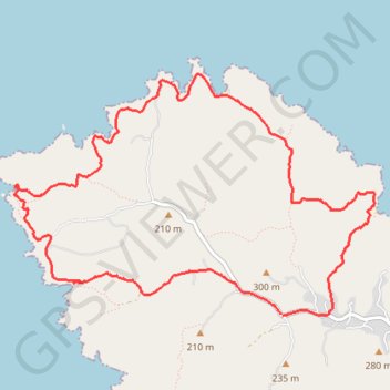
Name: Les criques du nord ouest de Folegandros GPS track, route, trail
Coordinates: 36.64795 24.84051 36.66585 24.87375
Other GPS tracks
Click on a GPS track to view route, its statistics and profile.
Le phare de Folegandros et Livadaki
Grèce > Égée > Περιφερειακή Ενότητα Θήρας > Άνω Μεριά > Αγκάλη
Randonnée pédestre. En aller simple. #Randonnée
Distance: 5.9 mi • Elevation gain: 1,827 ft • Maximum elevation: 843 ft