Les Sources
- Distance: 4.0 mi
- Elevation gain: 463 ft
- Maximum elevation: 318 ft
- Elevation loss: 463 ft
- Minimum elevation: 7 ft
Interactive map
GPS track profile
About this GPS track
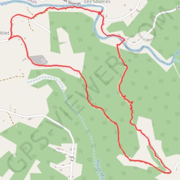
Name: Les Sources GPS track, route, trail
Start: Siblet, Grand-Bourg, Pointe-à-Pitre, Guadeloupe, 97112, France (15.93533 -61.30994)
End: Siblet, Grand-Bourg, Pointe-à-Pitre, Guadeloupe, 97112, France (15.93537 -61.30990)
Coordinates: 15.92267 -61.30994 15.93846 -61.29389
Other GPS tracks
Click on a GPS track to view route, its statistics and profile.
Portsmooth-Anse Canot
Dominique > Saint John Parish > Portsmouth
Distance: 32.6 mi • Elevation gain: 0 ft • Maximum elevation: 0 ft