Den Helder-Noordzeekanaal
- Distance: 48.1 mi
- Elevation gain: 692 ft
- Maximum elevation: 66 ft
- Elevation loss: 686 ft
- Minimum elevation: 0 ft
Interactive map
GPS track profile
About this GPS track
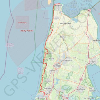
Name: Den Helder-Noordzeekanaal GPS track, route, trail
Coordinates: 52.46607 4.59785 52.96523 4.77868
Other GPS tracks
Click on a GPS track to view route, its statistics and profile.
Nethen-Groningen
Belgique > Brabant wallon > Nivelles > Grez-Doiceau
Distance: 233.6 mi • Elevation gain: 1,365 ft • Maximum elevation: 276 ft