Turtlehead Peak
Hike to the Turtlehead Peak via the Calico Tanks Trail and the Turtlehead Peak Trail in the La Madre Mountain Wilderness and the Red Rock Canyon National Conservation Area. #Hike #Mountain #Nature #Desert #Wilderness #Canyon
- Distance: 2.4 mi
- Elevation gain: 1,893 ft
- Maximum elevation: 6,220 ft
- Elevation loss: 115 ft
- Minimum elevation: 4,324 ft
Interactive map
GPS track profile
About this GPS track
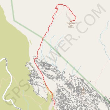
Name: Turtlehead Peak GPS track, route, trail
End: Turtlehead Peak Trail, Clark County, Nevada, United States (36.18023 -115.44598)
Coordinates: 36.16242 -115.45552 36.18381 -115.44468
Topography: Clark County topographic map
Other GPS tracks
Click on a GPS track to view route, its statistics and profile.