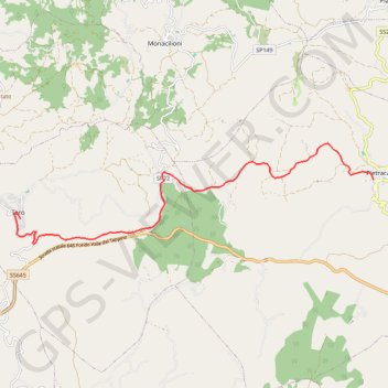
De Pietracalla à Toro
Randonnée entre Pietracatella et Toro. #Randonnée
- Distance: 8.2 mi
- Elevation gain: 1,083 ft
- Maximum elevation: 2,126 ft
- Elevation loss: 1,325 ft
- Minimum elevation: 1,024 ft
Interactive map
GPS track profile
About this GPS track
Name: De Pietracalla à Toro GPS track, route, trail
End: Toro, Campobasso, Molise, 86018, Italie (41.57095 14.76581)
Coordinates: 41.56535 14.76395 41.58770 14.87045
Other GPS tracks
Click on a GPS track to view route, its statistics and profile.
Percorso selezionato
Italie > Lombardie > Côme > Côme
Percorso calcolato con http://www.bicitalia.org/it/routing-gpx
Distance: 959.4 mi • Elevation gain: 58,894 ft • Maximum elevation: 3,392 ft