Gorham Mountain and The Beehive Loop (Mount Desert Island)
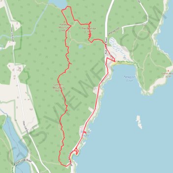
Loop hike from Sand Beach to Gorham Mountain and The Beehive via Bowl Trail, Beehive Trail, The Bowl, Gorham Mountain Trail, Cadillac Cliffs Path, Monument Cove, Thunder Hole and Ocean Path in the Acadia National Park. #Hike #Loop #Mountain #Nature #Forest #Park #Ocean #Atlantic #Sea, #Lake #Island
- Distance: 4.0 mi
- Elevation gain: 869 ft
- Maximum elevation: 492 ft
- Elevation loss: 873 ft
- Minimum elevation: 7 ft
- Moving time: 2 h 40 m
- Moving speed: 1.5 mph
- Maximum speed: 3.3 mph
- Total time: 3 h 7 m
- Global speed: 1.3 mph
- Date: 06/01/2023
Interactive map
GPS track profile
About this GPS track
Name: Gorham Mountain and The Beehive Loop (Mount Desert Island) GPS track, route, trail
Start: Satterlee Trail, Bar Harbor, Hancock County, Maine, United States (44.33024 -68.18447)
End: Satterlee Trail, Bar Harbor, Hancock County, Maine, United States (44.33010 -68.18435)
Coordinates: 44.31658 -68.19334 44.33606 -68.18355
Topography: Hancock County topographic map
Other GPS tracks
Click on a GPS track to view route, its statistics and profile.